Parametric BIM models engineered natively in Autodesk Revit versions 2020 through 2026 at LOD 200 and LOD 300.
For architecture firms, structural consultancies, and commercial general contractors, transitioning an existing building into an intelligent Autodesk Revit BIM environment is the critical first step of any adaptive reuse, commercial tenant improvement, or structural retrofit.
However, handling raw 3D laser scans (E57, LAS, RCS/RCP point clouds) inside Revit presents severe technical challenges:
- A single terrestrial scan can easily exceed 15 gigabytes, choking Revit workstation GPUs and bloating file sizes.
- Tracing noisy point clouds freehand creates non-orthogonal wall segments, unjoined corner miters, and misaligned floor levels.
- Because Autodesk Revit does not allow backwards-saving (a Revit 2024 file can never be opened in Revit 2022), version mismatch frequently creates project gridlock between consultants.
Through our dedicated Point Cloud to Revit BIM drafting services, HearthPlans converts laser scanner point clouds and iPhone LiDAR data into clean, native Autodesk Revit .rvt BIM models across all Revit versions from 2020 through 2026.
1. Point Cloud Indexing & Coordinate Reconciliation (Autodesk ReCap)
The Scan-to-BIM pipeline begins long before a wall is placed in Revit:
- Format Decoupling: Raw point cloud files (
.e57,.las,.pts, or mobile LiDAR.obj) are imported into Autodesk ReCap Pro. - Point Cloud Decimation & Noise Filtering: Ghost points caused by reflective glass windows, mirrors, moving personnel, and dust are cleaned and decimated to optimize viewport performance without sacrificing spatial accuracy.
- Unified Coordinate System (UCS): The scan is aligned to project True North and Project North, establishing a shared origin (0,0,0) and zero datum matching municipal property surveys.
- ReCap Output: Clean
.rcp(Project) and.rcs(Scan) point cloud indices linked into Revit via Origin-to-Internal-Origin or Shared Coordinates.
| Conversion Stage | Software Tool & Environment | Technical Operations | Revit BIM Deliverable |
|---|---|---|---|
| Stage 1: Raw LiDAR Point Cloud | Leica RTC360, FARO Focus, or iPhone Pro | Capture 10M–50M 3D coordinates; eliminate surface reflections, transient objects, and noise | Raw .E57 / .LAS / .PTS laser scan data |
| Stage 2: Autodesk ReCap Pro Indexing | Autodesk ReCap Pro (.RCP / .RCS) | Decimate point density, establish shared project origin (0,0,0), and define Level 1 / Level 2 datums | Indexed .rcp project file linked via Origin-to-Internal-Origin |
| Stage 3: Parametric Revit Modeling | Autodesk Revit (2020 through 2026) | Trace parametric composite walls, structural floor slabs, and door/window families to true as-built geometry | Native .rvt BIM model (LOD 200 or LOD 300) with plotted 24x36 sheet views |
2. Parametric Modeling Standards: LOD 200 vs. LOD 300
We model existing conditions according to BIMForum Level of Development (LOD) specifications:
Level of Development 200 (Schematic / Massing BIM)
- Generic wall thicknesses matching true measured physical profiles (e.g.
Generic - 5",Generic - 8",Generic - 12"). - Standard door and window openings with rough opening clearances.
- Uniform floor slabs and roof plates establishing volumetric envelope clearance for zoning and massing reviews.
Level of Development 300 (Permit-Ready & Construction BIM)
- Compound Wall Assemblies: Exact layered assemblies modeled with accurate core boundaries (e.g., Exterior 2x6 Wood Stud + 1/2" OSB Sheathing + 1" Rigid Ext Insulation + Stucco Finish; Interior 1/2" Gypsum Board).
- Structural Elements: True-dimensioned structural framing members, concrete stem walls, spread footings, LVL ridge beams, steel wide-flange beams, and concrete slab depressions.
- Component Parameterization: Doors, windows, and storefronts placed with accurate sill heights, head heights, casing profiles, and hardware clears.
- MEP Clearances: Major MEP equipment drops, electrical main distribution panels, grease ducts, and primary sanitary sewer exit sleeves.
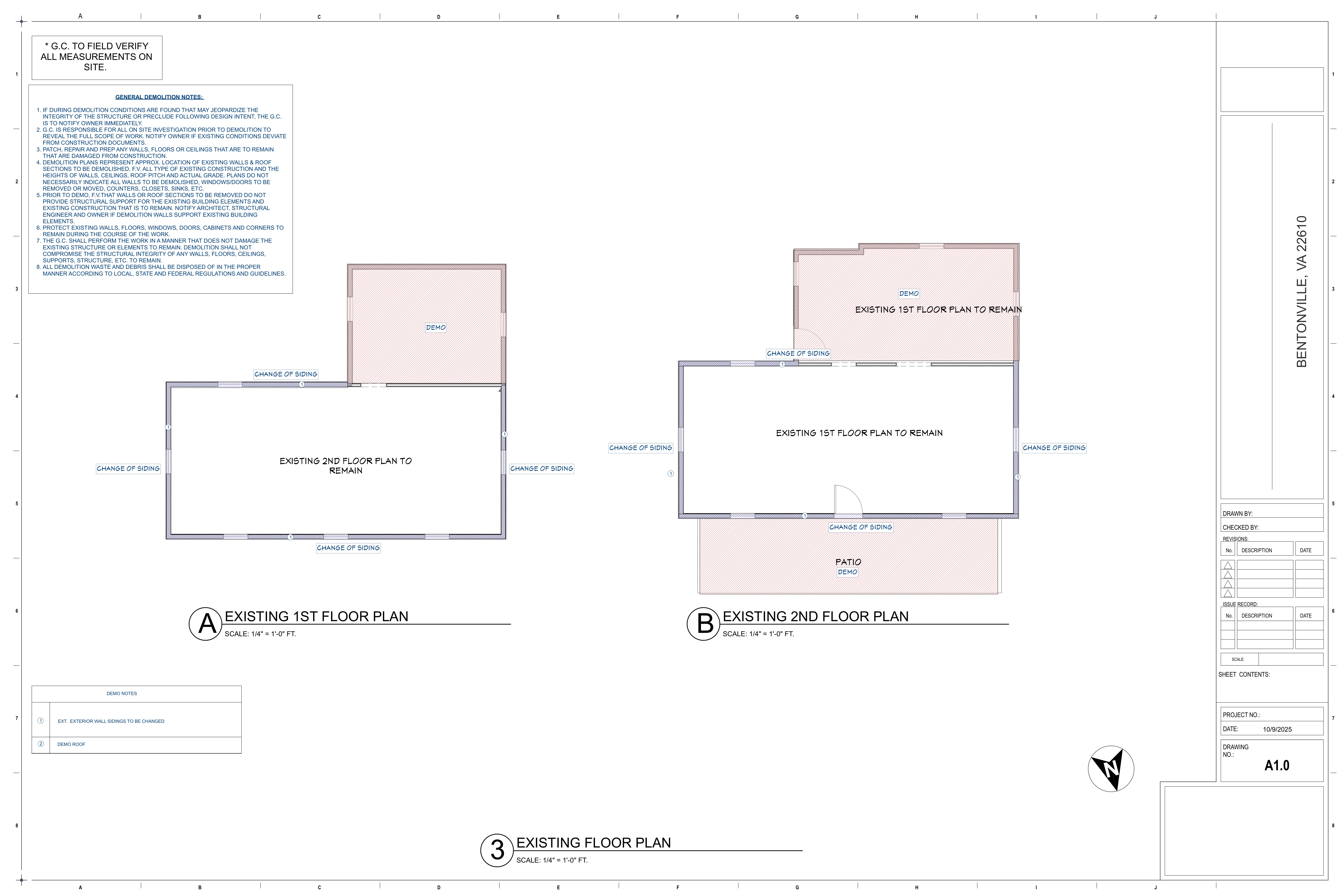
3. Existing vs. Demolition Phase Mapping
A major advantage of native Revit BIM modeling is phase coordination. When an existing building model is drafted properly, project architects can immediately generate demolition drawings and proposed new construction layouts without re-drawing walls.
Every element in our deliverable is assigned exact Revit Phase Properties:
- Phase Created:
Existing - Phase Demolished:
None(or flagged asDemolitionper client redlines) - Phase Filter Views: Pre-configured project browser views for:
- Existing Conditions Plan (All existing elements displayed solid).
- Demolition Plan (Walls to be removed shown dashed with standard redline notation).
- Proposed Construction Plan (New walls displayed with distinctive hatching).
4. Strict Version Control: Revit 2020 through 2026
Because Autodesk does not support downward compatibility, delivering a model in the wrong year can break a team's production pipeline.
At HearthPlans, our production studio maintains dedicated environments across all major Autodesk Revit releases:
- Autodesk Revit 2026
- Autodesk Revit 2025
- Autodesk Revit 2024
- Autodesk Revit 2023
- Autodesk Revit 2022
- Autodesk Revit 2021
- Autodesk Revit 2020
We also deliver standardized IFC 2x3 and IFC 4 models, along with fully synchronized, layered AutoCAD .DWG exports with AIA layer naming conventions (A-WALL, A-DOOR, S-COLS, E-POWR).
5. How to Submit Your Scan for Revit Conversion
- Upload Your Scan: Send an E57, LAS, RCP point cloud, or mobile LiDAR link (Polycam, Canvas, Matterport).
- Specify Software & LOD: Tell us your target Revit version (e.g., "Revit 2024, LOD 300") and required discipline scope (Architectural, Structural, or MEP).
- Receive a Fixed Quote: You receive a detailed scope, sheet schedule, and fixed price quote within 2 business hours.
- Fast Delivery: Your clean, organized
.rvtmodel and plotted PDF drawing set are delivered in 3 to 5 business days.
Get a fixed quote for your Scan-to-Revit BIM project or email your point cloud files directly to admin@hearthplans.com.
Beyond Standalone BIM: Full Permit Submittal Packages
Engineering studios and commercial architects require more than an isolated .rvt file—they require a coordinated, permit-ready sheet package that passes city plan review:
- Complete Sheet Sets: Plotted 24x36 or 30x42 PDF drawing sheets formatted with your firm's title blocks and AIA layer standards.
- Existing vs. Demolition Phases: Pre-configured Revit phases (
Existing,Demolition,New Construction) so you can generate demolition permit sheets with zero re-drafting. - Multi-Discipline Coordination: Structural framing integration, MEP clearance verification, and wall assemblies specified with true UL fire ratings.
Related Engineering Calculators & Permit Services
Coordinate your project drawings with these free interactive engineering calculators or request complete permit-ready drafting sheets from our studio.
Interactive Permit Calculators
Interactive 3D Digital Twin Viewer
Inspect, walk through, and dimension 3D architectural digital twins directly in your browser with real-time solar daylighting.
NEC 220 Panel Schedule Calculator
Draft matching electrical schedules for your as-built and proposed remodel drawings.
Permit Drafting Services
Scan to BIM & LiDAR As-Built Drafting
Convert iPhone LiDAR point clouds and Matterport scans into editable Chief Architect (.plan) or Revit (.rvt) models.
Architectural Drafting in DWG and PDF
Production drafting for floor plans, exterior elevations, cross-sections, and window/door schedules.